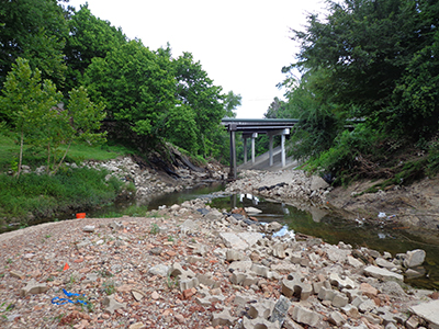
W140 Channel Improvements**
Harris County Flood Control District (HCFCD)
The project consisted of providing remedial recommendations for a failed slope along the Spring Branch Bayou near the intersection of Memorial and Chimney Rock in Houston. The original slopes were greater than 35-feet in height at some locations and steeper than 3:1 (horizontal:vertical). The slopes were experiencing erosion, shallow sloughs and deep-seated rotational slides.
Iterative analysis was performed to back calculate the shear strength of soils along the slopes. Soil borings and laboratory test data was used to provide remedial recommendations. The remedial recommendations included flattening the slope, drilled pier reinforcement and riprap protection.
**Project listed is representative of Kenall Geo staff’s diversified experience from previous professional engagements. Kenall Geo staff acted as the Geotechnical Project Manager and/or Geotechnical Engineer-of-Record (EOR) on the project while they were with their previous employer.

